
Rhode Island
- Area:
- Area: 1,545 sq.mi (4,002 sq.km.), 50th
- Land: 1,045 sq.mi. (2,707 sq.km.), 50th
- Water: 500 sq.mi. (1,295 sq.km.), 41st
- Coastline: 40 mi. (64 km.), 19th
- Shoreline: 384 mi. (618 km.), 20th
- Border States:
- Climate:
- County Profile:
Rhode Island County Map , 5 Counties
- Geographic Center:
Kent, 1 mile southsouthwest of Crompton
- Highest Point:
Jerimoth Hill ; 812 feet, (247 m.) 46th tallest
- Location:
- Absolute Center: 41°40.3’N / 71°34.6’W
- Relative Center: Kent, 2.5 miles south southwest of Crompton
- Distance Between U.S. Cities
- Lowest Point:
Rhode Island; sea level, tied for 3rd lowest
- Maps:
- National Forest:
- Topography:
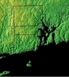
Image | | Eastern lowlands of Narragansett Basin; western uplands of flat rolling hills.
- Weather:
- Community and Technical Colleges:
- Nursing Schools:
- School Directory:
- Biographies:
- Community Pages:
- Current Events:
- Media:
- Newspapers:
- Sports:
- Yellow Pages:
- Library:
- Museums:
- State Parks:
- History:
- Economy:
- Agriculture: Nursery stock, vegetables, dairy products, eggs.
- Industry: Fashion jewelry, fabricated metal products, electric equipment, machinery, shipbuilding and boatbuilding, tourism.
- White Pages:
- Internet Service Providers:
- Real Estate:
- Unclaimed Funds:

- Admission to Statehood:
May 29, 1790 (13th State)
- Area:
- Area: 1,545 sq.mi (4,002 sq.km.), 50th
- Land: 1,045 sq.mi. (2,707 sq.km.), 50th
- Water: 500 sq.mi. (1,295 sq.km.), 41st
- Coastline: 40 mi. (64 km.), 19th
- Shoreline: 384 mi. (618 km.), 20th
- Constitution:
Rhode Island’s Constitution , 13th State
- Capital City:
- Nickname:
- Population (2019):
1,051,511; Rank: 43 of 50 | Population Quick Facts
- Area Codes:
- Bird:
- Capital City:
- City Guides:
- Constitution:
Rhode Island’s Constitution , 13th State
- Fast Facts:
- Flag:

Placed on a white field is a circle of thirteen gold stars representing the first thirteen states. The stars surround a gold ship’s anchor. The state’s motto “Hope” is on a blue ribbon below the anchor.
Get this Flag - Flower:
Violet (Viola) | Other State Flowers
- Largest Cities:
Providence | Warwick | Cranston | Pawtucket | East Providence | Woonsocket | Newport | Central Falls
- Nickname:
- Origin of State Name:
Possibly named in honor of the Greek Island of Rhodes or was named Roode Eylandt by Adriaen Block, Dutch explorer, because of its red clay
- Population (2019):
1,051,511; Rank: 43 of 50 | Population Quick Facts
- Soil:
Narragansett
- Song:
- “Rhode Island’s It for Me” | Words by: Charlie Hall | Music by: Charlie Hall
- Other State Songs | Sheet Music
- State Quarter:
- Symbols:
- Tree:
Red Maple (Acer rubrum) | Other State Trees
- Zip Codes:
- Capital Tour:
- County Profile:
Rhode Island County Map Rhode Island County Map , 5 Counties
- Courts:
- Department of:
- Driving:
- Highway Markers:
- Local Resources:
- Public Records:
- Representatives:
- Roadside America:
- Vital Records: