South Carolina
- Area:
- Area: 32,007 sq.mi (82,898 sq.km.), 40th
- Land: 30,111 sq.mi. (77,987 sq.km.), 40th
- Water: 1,896 sq.mi. (4,911 sq.km.), 21st
- Coastline: 187 mi. (301 km.), 11th
- Shoreline: 2,876 mi. (4,628 km.), 11th
- Border States:
- Climate:
- County Profile:
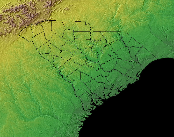
South Carolina County Map , 46 Counties
- Geographic Center:
Richland, 13 miles southeast of Columbia
- Highest Point:
Sassafras Mountain ; 3,560 feet, (1,085 m.), 29th tallest
- Location:
- Absolute Center: 33°49.8’N / 80°52.4’W
- Relative Center: Richland, 13 miles southeast of Columbia
- Distance Between U.S. Cities
- Lowest Point:
South Carolina; sea level, tied for 3rd lowest
- Maps:
- National Forest:
- Topography:
Image | | Blue Ridge province in northwest has highest peaks; piedmont lies between the mountains and fall line; coastal plain covers two-thirds of the state.
- Weather:
- Community and Technical Colleges:
- Nursing Schools:
- School Directory:
- Biographies:
- Community Pages:
- Current Events:
- Media:
- Newspapers:
- Presidential Birthplace:
- Andrew Jackson, 1829-1837 (7th) | March 15, 1767 | Waxhaw, South Carolina
- Sports:
- Yellow Pages:
- Library:
- Museums:
- State Parks:
- History:
- Economy:
- Agriculture: Tobacco, poultry, cattle, dairy products, soybeans, hogs.
- Industry: Textile goods, chemical products, paper products, machinery, tourism.
- White Pages:
- Internet Service Providers:
- Real Estate:
- Unclaimed Funds:

- Admission to Statehood:
May 23, 1788 (8th State)
- Area:
- Area: 32,007 sq.mi (82,898 sq.km.), 40th
- Land: 30,111 sq.mi. (77,987 sq.km.), 40th
- Water: 1,896 sq.mi. (4,911 sq.km.), 21st
- Coastline: 187 mi. (301 km.), 11th
- Shoreline: 2,876 mi. (4,628 km.), 11th
- Constitution:
South Carolina’s Constitution , 8th State
- Capital City:
- Nickname:
- Population (2019):
4,774,839; Rank: 24 of 50 | Population Quick Facts
- Area Codes:
- Bird:
- Capital City:
- City Guides:
- Constitution:
South Carolina’s Constitution , 8th State
- Fast Facts:
- Flag:

Asked by the Revolutionary Council of Safety in the fall of 1775 to design a flag for the use of South Carolina troops, Col. William Moultrie chose a blue which matched the color of their uniforms and a crescent which reproduced the silver emblem worn on the front of their caps. The palmetto tree was added later to represent Moultrie’s heroic defense of the palmetto-log fort on Sullivan’s Island against the attack of the British fleet on June 28, 1776. Get this Flag - Flower:
Yellow Jessamine (Gelsemium sempervirens) | Other State Flowers
- Largest Cities:
- Nickname:
- Origin of State Name:
Taken from Carolus, the Latin word for Charles, and named after England’s King Charles I
- Population (2019):
4,774,839; Rank: 24 of 50 | Population Quick Facts
- Soil:
Bohicket
- Song:
- “Carolina” | Words by: Henri Timrod | Music by: Anne C. Burgess
- Other State Songs | Sheet Music
- State Quarter:
- Symbols:
- Tree:
Sabal Palm (Sabal palmetto) | Other State Trees
- Zip Codes:
- Capital Tour:
- County Profile:
South Carolina County Map South Carolina County Map , 46 Counties
- Courts:
- Department of:
- Driving:
- Highway Markers:
- Local Resources:
- Public Records:
- Representatives:
- Roadside America:
- Vital Records: